County · code 40113
Osage CountyOklahoma
Osage County, Oklahoma is a county in Oklahoma with its seat in Pawhuska, formed in 1907.
- Founded1907
- County seatPawhuska
- Named forOsage Nation
- Land area2,247 sq mi + 57 sq mi water
- Population45,818 2020 Census
- Parcels mapped42,072 checked 16 October 2026
Where it is
Osage on the map of Oklahoma
Oklahoma has 77 counties and county equivalents, each with its own records office. Shapes with a page are links.
History
Founded in 1907
An old deed may name a county that no longer exists, or a boundary that has since moved.
Osage County was created on November 16, 1907, from non-county area in the former Oklahoma Territory, specifically from the Osage Indian Reservation. The county was named after the Osage Nation.
- 1907Osage County created Osage created from non-county area in the former Oklahoma Territory (Osage Indian Reservation). · Okla. Constitution [1907], art. 17, sec. 8; Swindler, 8:152
Land and parcels
What the maps cover in Osage
Who publishes each layer, how good it is, and when we last checked.
-
Parcels Good enough
Lot lines and tax-map numbers for 42,072 parcels from Osage County. Drawn for tax purposes: usually within a few feet of a survey, but not a survey.
checked 16 October 2026 -
Address points Missing
No public address points layer found for Osage County yet.
-
Buildings Reference
Roof outlines traced from aerial imagery from FEMA Response Geospatial Office with Oak Ridge National Laboratory (ORNL). Good for seeing what is on a lot; not accurate enough to set a fence from.
checked 18 October 2026
- Official
- from the office that keeps the record
- Good enough
- a reliable statewide or national copy
- Fallback
- a guide only; check the official record
- Missing
- nothing public found yet
People and land
Osage by the Census
Source: US Census Bureau, 2020 Census; US Census Bureau, 2020 Gazetteer Files. Not endorsed or certified by the Census Bureau.
Rules and offices
Who to ask before you build, dig or sell
Official county pages only. We link to them; we do not copy them, because they change.
Inside a city or town, permits usually come from that city rather than the county.
Zoning and code
County government
- County government
The official website of Osage County.
See your own lot on these maps
Open Osage County on Parcel Chart's free map and click your parcel. Save it with a free account; the full record of your place (site map, projects, documents) is Pro, in early access.
Questions
Common questions about Osage County
- When was Osage County founded?
- Osage County was founded in 1907, and named after Osage Nation.
- What is the county seat of Osage County?
- The county seat of Osage County is Pawhuska.
- Is there an online parcel map for Osage County?
- Yes. Osage County publishes a parcel map of 42,072 parcels, rated good enough here. You can click any parcel on it in Parcel Chart's free map, no sign-in needed.
- Has Osage County's boundary or name changed?
- Osage County was created in 1907. The Atlas of Historical County Boundaries records no boundary change since.
- Who issues building permits in Osage County?
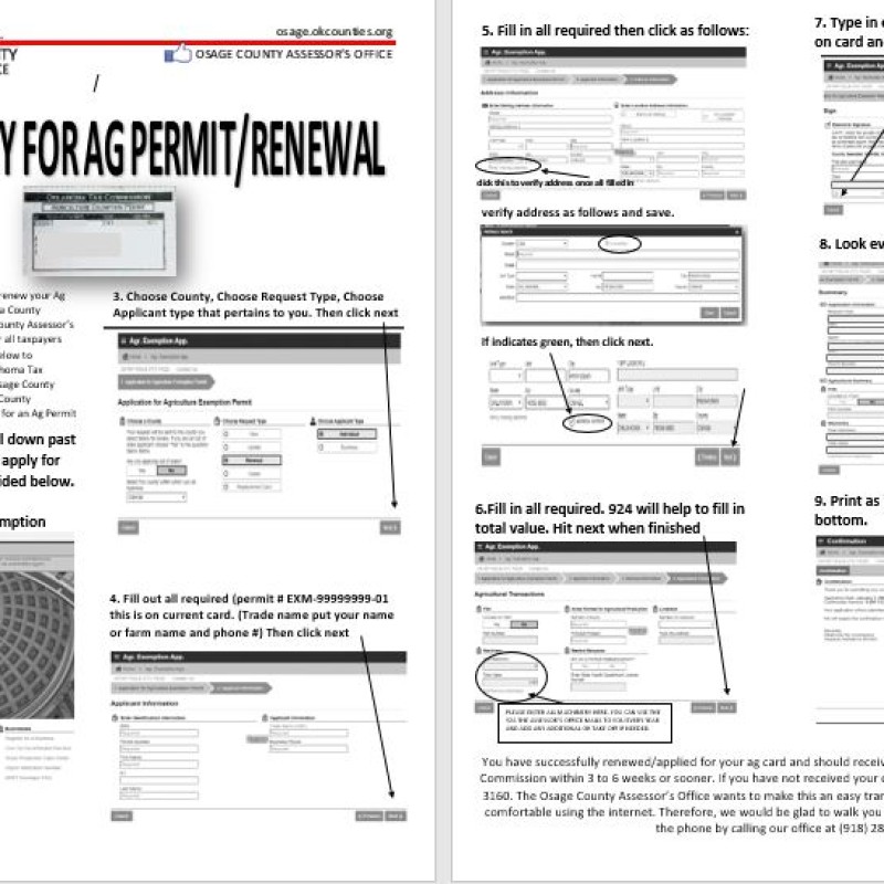
- The county's page on building permits: AG PERMIT ONLINE INSTRUCTIONS. Inside a city or town, ask that city first.
- Is my lot in a flood zone?
- We do not have flood maps for Osage County yet. Look up the address on FEMA's Flood Map Service Center, which shows the effective flood map for any lot.
Nearby